Ahmed Shahin Khalisdar - archive
Trigonometrical Plan of the Backwater at Ras Al Khaimah
1822 - Ras Al Khaimah
Before / After Restoration
Description
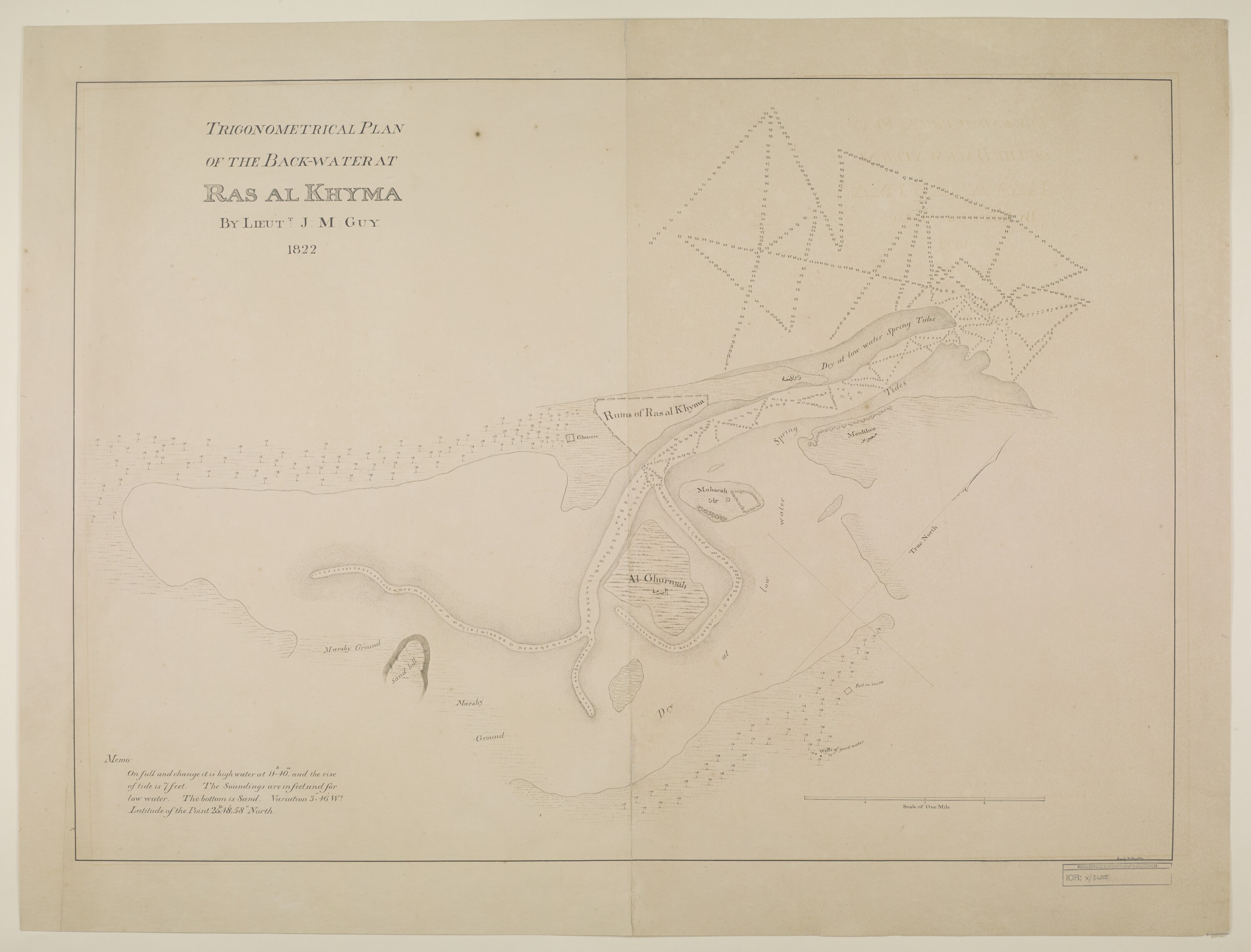
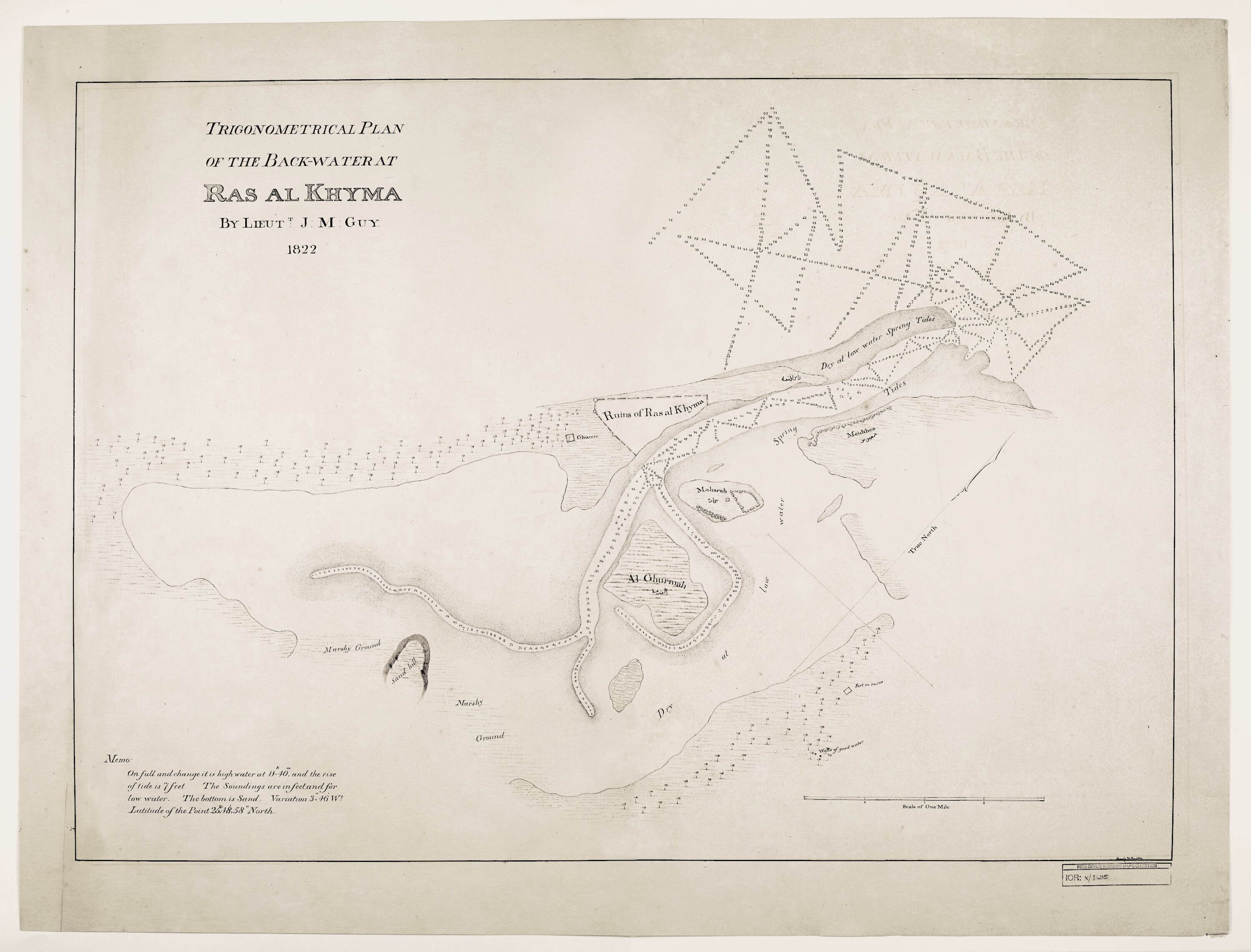
This 1822 Trigonometrical Plan of the Backwater at Ras al Khyma, surveyed by Lieut. J. M. Guy and drawn by M. Houghton, offers one of the earliest detailed cartographic records of Ras Al Khaimah. Produced during the period of intensifying British engagement with the Trucial Coast in the aftermath of the 1820 General Treaty, the survey documents the waterway and settlement with a precision unusual for the era.
On the map, the site labeled Ghurrie marks the location of what is now Hisn Ras Al Khaimah, the fort that today houses the National Museum of Ras Al Khaimah. The term derives from the Hindustani and Arabic Garhi (الغرية / गढ़ी), meaning fortified enclosure. Early British surveyors frequently used this transliteration, as seen in other 19th-century records of the region.
To the southeast lies the Island of Maharra, a small, once-fortified landform that has since vanished through natural and manmade changes to the coastline - a reminder that Ras Al Khaimah's geography, like its history, has continually evolved. The map is held in the British Library Map Collections under reference IOR/X/3685.
Restoration Notes
- Damage: Paper creasing across the central field
- Damage: Yellowing and tonal shift from age
- Damage: Surface contamination along fold lines
- Work: Crease removal and paper texture restoration
- Work: Yellowing normalised to original paper tone
- Work: Tonal reconstruction to recover line legibility
- Work: Edge detail stabilised
From the British Library Map Collections (Ref: IOR/X/3685). Digitised from the original manuscript. Surveyed by Lieut. J. M. Guy; drawn by M. Houghton, 1822.
Full Images
Citation
Guy, J. M., surveyor, and M. Houghton, draughtsman. "Trigonometrical Plan of the Backwater at Ras Al Khaimah." 1822. British Library Map Collections, IOR/X/3685. Restored 2026. Image Restoration Archive, khalisdar.org. https://khalisdar.org/archive/1822-trigonometrical-plan-backwater-ras-al-khaimah/