Ahmed Shahin Khalisdar - archive
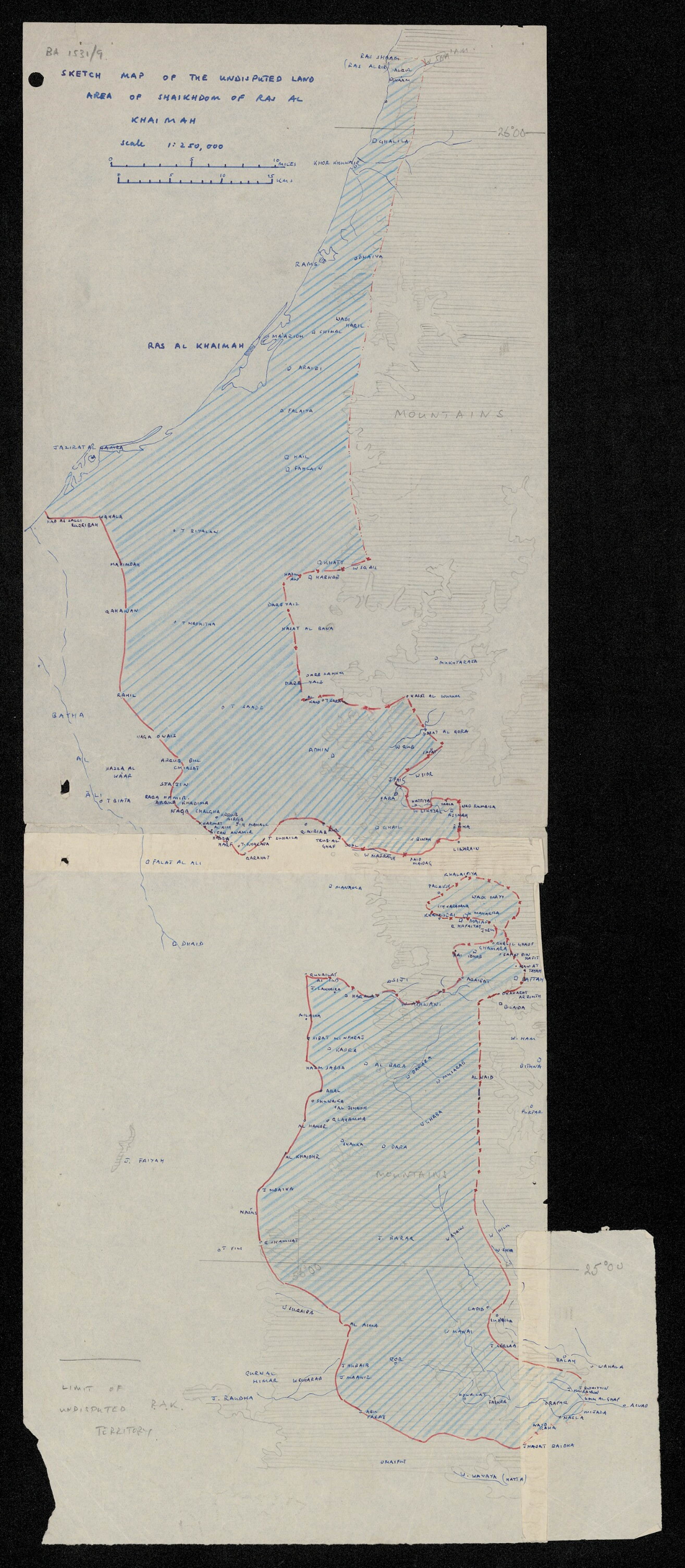
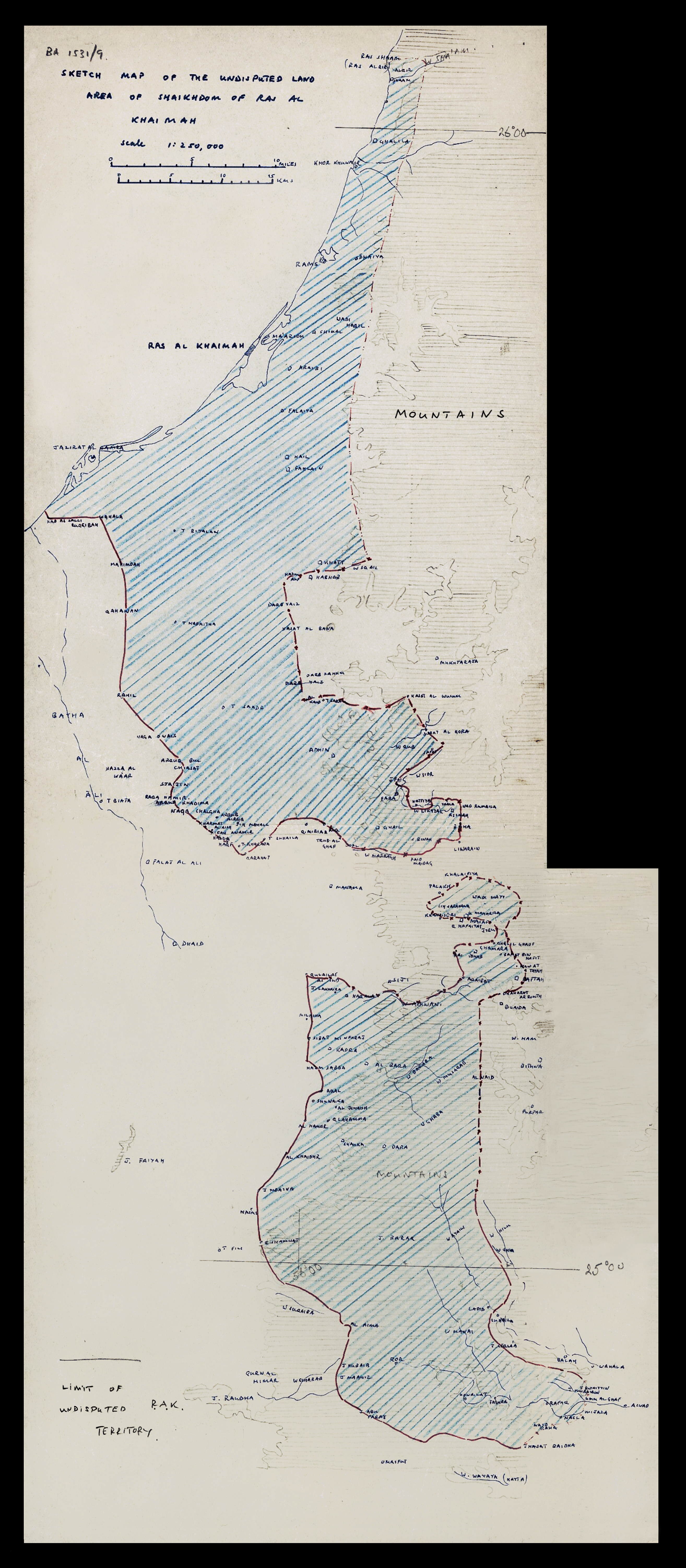
Sketch Map of the Undisputed Land Boundary of the Sheikdom of Ras Al Khaimah
1959 - Ras Al Khaimah
Before / After Restoration
Description
This 1959 sketch map constitutes one of the few surviving British administrative documents to delineate the undisputed land boundary of the Sheikdom of Ras Al Khaimah in the late Trucial States period. Produced within the context of British political residency administration across the lower Gulf, such maps were working documents - instruments of governance rather than finished cartographic statements - and their survival in institutional archives is correspondingly uneven.
The file from which this document originates, FCO 18/2007 held at The National Archives in London, carries the standard security grading markings of H.M. Diplomatic Service files of the period. The cover sheet bears the notation UNCLASSIFIED and the stock number FC4420, indicating its eventual declassification and transfer to the public record. Together with the 1822 Trigonometrical Plan, this map offers a rare longitudinal view of how Ras Al Khaimah's territorial extent was understood and recorded across more than a century of British engagement with the region.
The map is reproduced by permission of The National Archives, London, England.
Restoration Notes
- Damage: Overall yellowing and age-related tonal shift
- Damage: Surface dust and contamination
- Damage: Contrast loss reducing legibility of boundary lines
- Damage: Marginal text fading
- Work: Tonal normalisation to recover paper ground
- Work: Contrast reconstruction to restore line definition
- Work: Dust removal and surface cleaning
- Work: Marginal text legibility improved
Document Transcript (Cover Sheet)
FCO 18/2007 | Cover sheet - transcribed from originalFrom The National Archives, London (FCO 18/2007, Stock No. FC4420). © Images reproduced by permission of The National Archives, London, England. Digitised from the original file.
Full Images
Citation
"Sketch Map of the Undisputed Boundary of the Sheikdom of Ras Al Khaimah." 1959. The National Archives, London, FCO 18/2007 (Stock No. FC4420). Restored 2026. Image Restoration Archive, khalisdar.org. https://khalisdar.org/archive/1959-sketch-map-undisputed-boundary-ras-al-khaimah/